Tsévié
Tsévié is a city and canton in the Maritime Region of Togo. It is situated 32 km north of the capital Lomé and at the 2010 Census had a population of 54,474. The city is inhabited primarily by Ewe people. It is the capital of the prefecture of Zio and the Maritime Region.
The town is an important market centre for trading and is noted for its palm oil processing. Tsévié has road and railway links with Notsé, Atakpamé, and Blitta to the north and with Lomé to the south. The inhabitants of the city used to worship idols, but now many follow Christianity. Their traditional celebration is Ayizan, in which they demonstrate their old traditions, but now use this celebration as a symbol for unity and peace. Tsevie is a developing city that attracts many tourists.
Tsévié is twinned with:
* ?? Parthenay, France, since 1990
* ?? Plainfaing, France, since 2015
Map - Tsévié
Map


Country - Togo
 |
 |
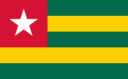
| Flag of Togo | |
Various people groups settled the boundaries of present day Togo between the 11th to 16th centuries. Between the 16th and 18th centuries, the coastal region served primarily as a European slave trading outpost, earning Togo and the surrounding region the name "The Slave Coast". In 1884, Germany declared a region including a protectorate called Togoland. After World War I, rule over Togo was transferred to France. Togo gained its independence from France in 1960. In 1967, Gnassingbé Eyadéma led a successful military coup d'état, after which he became president of an anti-communist, single-party state. In 1993, Eyadéma faced multiparty elections marred by irregularities, and won the presidency three times. At the time of his death, Eyadéma was the "longest-serving leader in modern African history", having been president for 38 years. In 2005, his son Faure Gnassingbé was elected president.
Currency / Language
| ISO | Currency | Symbol | Significant figures |
|---|---|---|---|
| XOF | West African CFA franc | Fr | 0 |
| ISO | Language |
|---|---|
| EE | Ewe language |
| FR | French language |
| HA | Hausa language |